Kümmerly+Frey (Switzerland)
(Source Kümmerly+Frey)
The Hallwag Kümmerly+Frey tourist map programme.
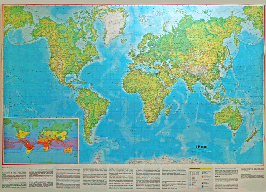
We produce the following types of maps: Road maps, regional maps, city maps, travel guides and road atlases, continental and world maps, panoramic maps, hiking guides, excursion and bicycle maps. A wide-ranging series of tourist maps with up-to-date, detailed information to help you plan your journey, and make travelling easier.
Hallwag Kümmerly+Frey is the leading publishing house in Switzerland for tourism. Our international distribution network has ensured a worldwide presence and made our familiar red/yellow and blue maps famous everywhere. Swiss cartographic standards guarantee you a high level of accurate information.
To round off its tourist package, Hallwag Kümmerly+Frey AG is also the exclusive Swiss supplier of many famous travel guide series including Baedeker, Marco Polo, Dumont, Vis-à-Vis, Falk Spirallo, LONELY PLANET, promobil, Caravaning, HB atlases, National Geographic Germany and Frederking & Thaler.
Hallwag Kümmerly+Frey AG also has two special series, which are a perfect addition to your leisure time information:
- The hiking maps and guides from the Swiss Alpine Club (SAC)
- The excursion maps and leisure guides from the Kompass publishing house.


 Italiano