Code: TFMCOL2E
Editor / Manifacturer: The Future Mapping
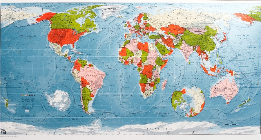
Category: Physical-political map
Language: English
Dimensions: 120 x 66 cm
Availability: ![]()
Shipment Time: Prompt deli.

The map combines both political and physical information including plate tectonic boundaries and see bed relief. Utilising the respected Robinson projection the map presents a non-bias compromize between the shape and size of countries. Detail includes a shaded relief layer, plate tectonic boundaries & direction of movement, capital & major cities, rivers, roads, airports, peaks, time zones & north/south pole projection.
-

 Italiano